

Service Line
+49 (0) 2203 97710-0
Search & Locate
Products MAGNEX® 120 LW Wheeled system
Multi Channel Systems
Features
-
Increased productivity when surveying large areas
-
Reduced personnel requirement
-
Improved data quality
-
Rapid and simple assembly and dismantling
-
Modular design
-
GPS option
Efficiency through multi-Channel systems
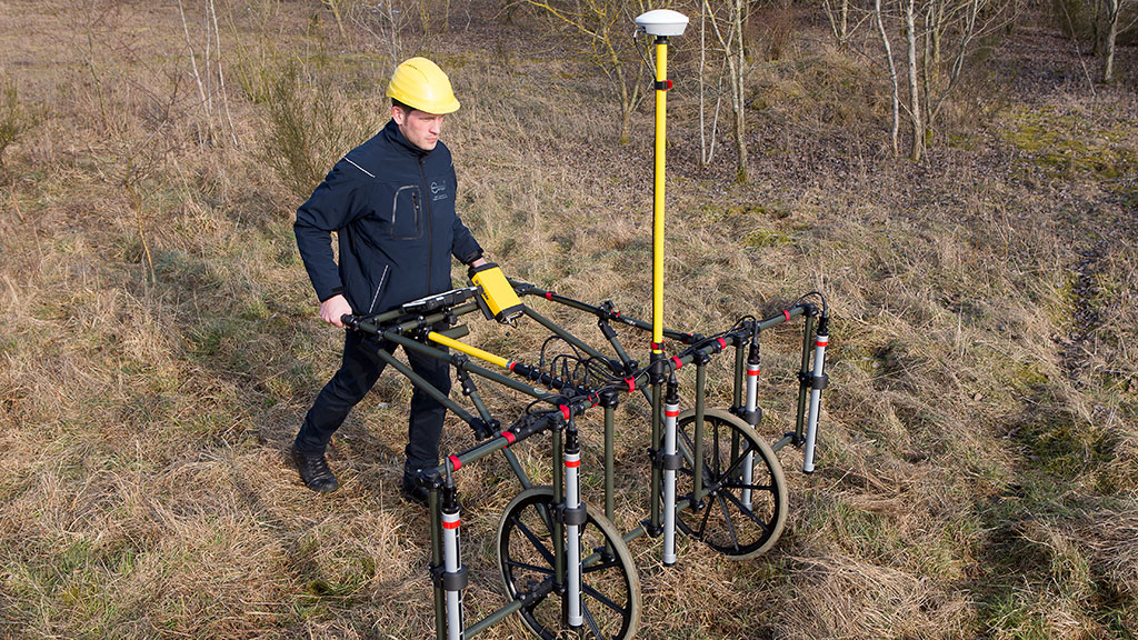
To improve productivity and increase the quality of the data obtained when field mapping, EBINGER offers the MAGNEX® 120 LW as multi-channel systems. If required these can be enhanced with a GPS system.
3-channel-system
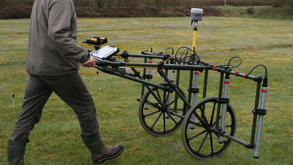
The TR01-03 carrier is fitted with three MAGNEX® 120 LW probes which are arranged at distances apart of 50 cm. The power supply consisting of the MAGNEX® 120 battery box is integrated in the carrier. The carrier can be handled by one operator in one day and the productivity is increased by a factor of three. The average area able to be mapped by one operator is around 1.8 to 2 hectares. For mapping on largely level ground the TR01-03 carrier can be enhanced with the TR01-02RAD wheel set.
5-channel-system
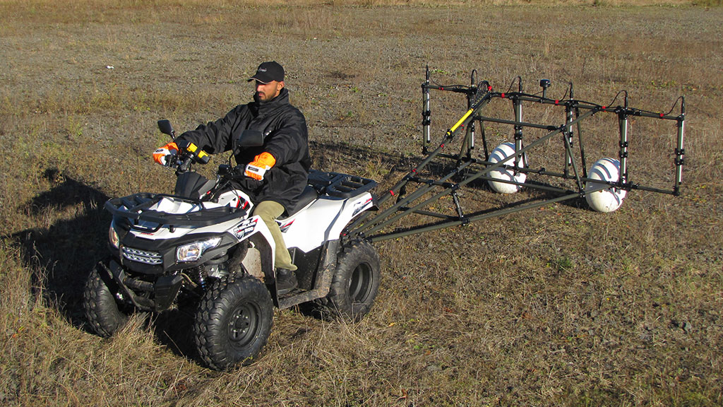
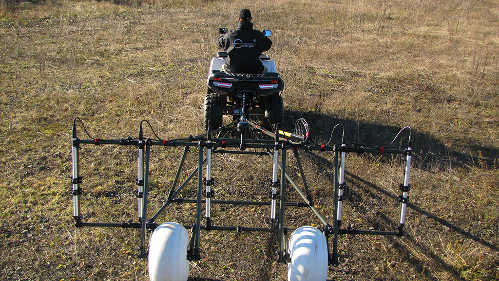
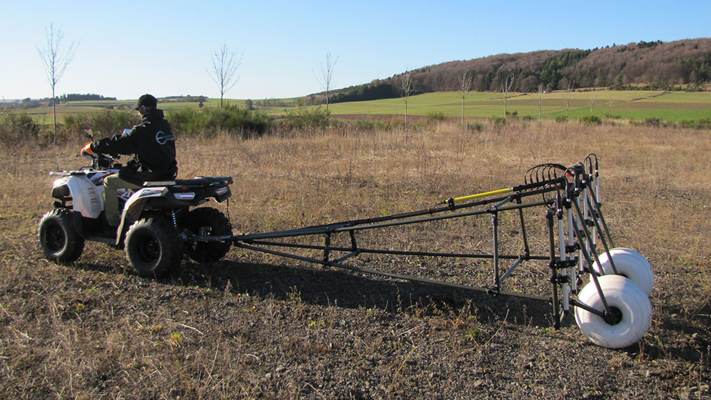
With the 5-channel system the average area able to be mapped per person and day is around 3.6 hectares. The extension set TR01-05 UPGR permits two further MAGNEX® 120 probes to be used giving a total of five probes. For high resolution mapping these can be mounted at distances apart of 25 cm. The TR02-05 carrier has a width of 2 metres and can carry five MAGNEX® 120 probes, these being mounted at distances of 50 cm from each other. By reason of its dimensions the TR02-05 carrier is delivered as standard with the TR01-02 RAD wheel set.
Vehicle-mounted multi-channel system
For mapping large areas or for long paths as well as also for use on water EBINGER offers vehicle-mounted and GPS-supported multi-channel systems with data recording and visualization software.
Depending on the particular detection location and the working conditions the average mapping result is in the range of approximately 12 hectares per day for a four metre wide vehicle-mounted frame.
Digital recording of measured data
The EPAD® data logger and the EPAS® software are perfectly matched to one another and form the firstclass EBINGER system for recording, processing, visualizing and evaluating digital data for explosive ordnance disposal work. The EPAD® data logger can be used in the field as a single channel or multi-channel system (up to 6 channels). The EPAS® software carries out the complex data processing and evaluating steps automatically in the background. The EBINGER system is characterized in particular by the simplicity of use as well as by its multilingualism. EPAD® data logger, EPAS® software and EBINGER locators: the ideal tools for explosive ordnance disposal.
Work planning advantages
-
Reduced expense for excavations
-
Material and personnel requirement planning can be optimizedv
-
Clearance priorities can be defined
-
-
Easy planning of clearance priorities
-
The EPAS® software presents the detection data as two-dimensional colour-coded maps and/or as ISO line charts. Each way of visualization can be configured separately in respect of limit values and sensitivity. The detection data visualization can be superimposed on geographical maps.
The models, which are used in the evaluation of the magnetic anomaly and pulse-electromagnetic induction data, facilitate interpreting of the objects that have been localized in respect of their.
Downloads
- Ebinger 50th anniversary news