

Service Line
+49 (0) 2203 97710-0
Search & Locate
Products UPEX® 740 M
Large Loop metal locator
Features
-
High productivity
-
Simple to train and to operate
-
Option for digital surveys
-
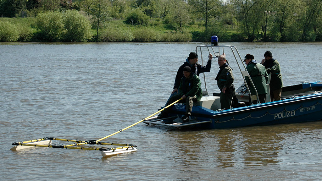
On water and normal land use
General
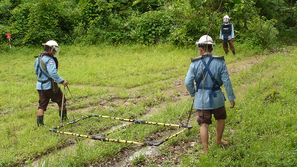
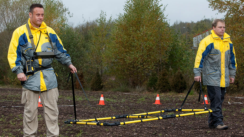
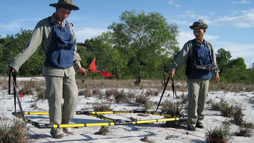
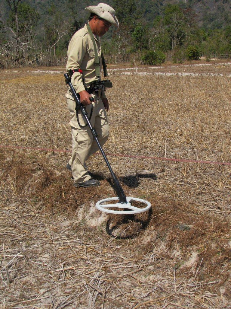
The UPEX® 740 M PI large-loop detection system supports a fast search of large areas after metal objects of substantial size buried deep in the ground. Depending on the vegetation, areas of several ha can be surveyed with one unit within one day.
The UPEX® detects ferrous and non-ferrous metals as well as alloys. It is ideally suited for locating underground dumps, pipelines, stores, manholes and sewer shafts, UXOs, sunken vehicles and other metal objects of relatively large dimensions.
The system, which is widely used in forensic policework and MineAction is easy to use, to train and surpasses the detection range and productivity of the conventional type of metal detectors with standard small halo search heads.
The UPEX® 740 M can suppress the indication of small metal scrap. This saves time for the excavation of unwanted small scrap.
Simple to operate
-
Short familiarization time
-
Unambiguous and clear display
-
Robust
Low risk of the device being operated incorrectly • Optional: Multilingual EPAD® data logger and EPAS® software for digirtal surveys
Work planning advantages
-
Less operation cost
-
Possibility to optimize planning of assets
-
Priorities of areas to be cleared can be determined
The EPAS® software presents the measurement data as two-dimensional colour-coded maps and/or as ISO line charts. Each form of visualization can be configured separately in respect of limit values and sensitivity. The data visualizations can be linked to GPS co-ordinates and can be superimposed to geographic maps.
Supported by EPAS®/EPAD®
UPEX® 740 M supports digital mapping as the detection data can be recorded via a data output socket at the electronic box. The EPAD® data logger stores the values measured by the metal detector for subsequent processing, interpretation and conversion into a coloured-coded map. This version is in conformity with the requirements of GIS systems (geo-information systems) and supports IMSMA (Information Management System of Mine Action).
The geo-referencing system allows a timewise separation of detection
Downloads

- Ebinger 50th anniversary news